Medieval Settlements of Great Bradley
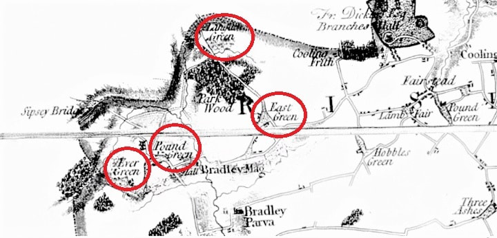
Hodgkinson’s Map of Suffolk published in 1783 was the first detailed map of the county and remained so for another 40 years. For the Great Bradley area it showed four ‘greens’ that have medieval origins but are now lost to us: Over Green, Pound Green, Long Acre Green and East Green.
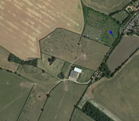
The picture above shows the location of the medieval settlement ove Over Green (which became Evergreen) at the end of Matthews Lane.
The picture above shows the location of the medieval settlement ove Over Green (which became Evergreen) at the end of Matthews Lane.
OVER GREEN OR EVER GREEN
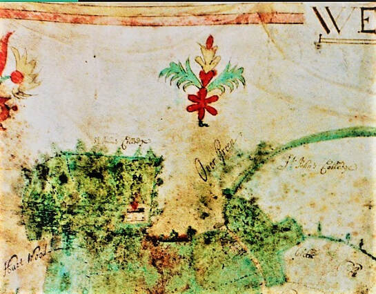
The map of 1719 (below left) shows Over Green which, 40 years later, was known as Ever Green. The green is beyond the farm gate at the end of what we now know as Matthew’s Lane, which was previously called Evergreen Lane. (Evergreen Lane was altered to be an L-shaped road when new houses built in the 1950s). There is good evidence for a medieval settlement there and we shall look in more detail at this next time. The 1767 map (below right) is the opposite way up to the 1719 map but shows that the extent of the green and the buildings at Over Green at the time.
The map of 1719 (below left) shows Over Green which, 40 years later, was known as Ever Green. The green is beyond the farm gate at the end of what we now know as Matthew’s Lane, which was previously called Evergreen Lane. (Evergreen Lane was altered to be an L-shaped road when new houses built in the 1950s). There is good evidence for a medieval settlement there and we shall look in more detail at this next time. The 1767 map (below right) is the opposite way up to the 1719 map but shows that the extent of the green and the buildings at Over Green at the time.
|
|
|
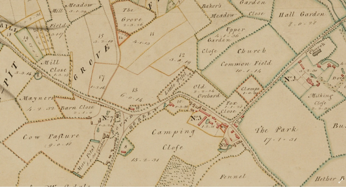
POUND GREEN
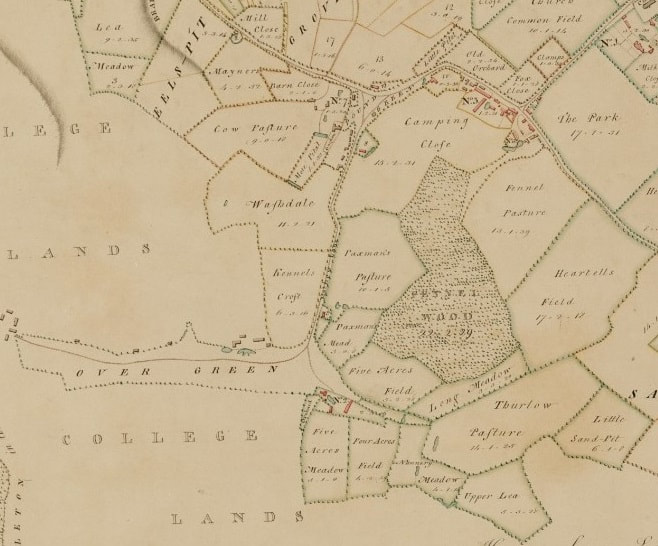
The medieval area of Pound Green is where current day Evergreen Lane joins the main road. It occupied an area between the current Old Rectory near Water Lane and Bluebell Cottage on the bend near the village sign. It extended down to Over Green, but it has been eroded over the years. These maps, from 1719 and 1767, show the triangular area of the green (n.b. the maps are orientated in opposite directions). I have marked the location of the current Yew Tree Cottage, which would have sat overlooking Pound Green at one time.
The medieval area of Pound Green is where current day Evergreen Lane joins the main road. It occupied an area between the current Old Rectory near Water Lane and Bluebell Cottage on the bend near the village sign. It extended down to Over Green, but it has been eroded over the years. These maps, from 1719 and 1767, show the triangular area of the green (n.b. the maps are orientated in opposite directions). I have marked the location of the current Yew Tree Cottage, which would have sat overlooking Pound Green at one time.
LONG ACRE OR LARNACRE GREEN
Long Acre (or Larnacre) Green is the site of a medieval settlement and two farms called Long Acre Farm and Galley’s Farm. It survived into the 20th Century but hardly any trace remains now. If you go over the ford and up the path beside weirs of Kirtling Brook from Great Bradley to the point where parking is possible at the Kirtling side of a weir, you will see the remains of buildings amongst the trees on the Great Bradley side. The map to the left shows Long Acre Farm in 1865.
Galleys Farm is believed to have been at the bottom of the map area and it has been suggested that the name is derived from the fact that there may have been a gallows nearby. In the LiDAR image alongside an arial view of the area Long Acre Farm is on the dog-leg in the path and Galley’s Farm is at the bottom of the picture
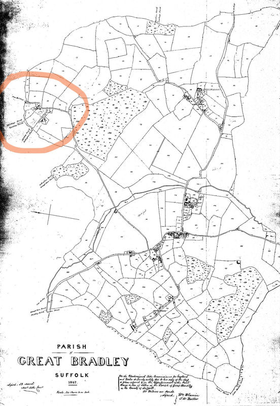
1842 Map of Great Bradley
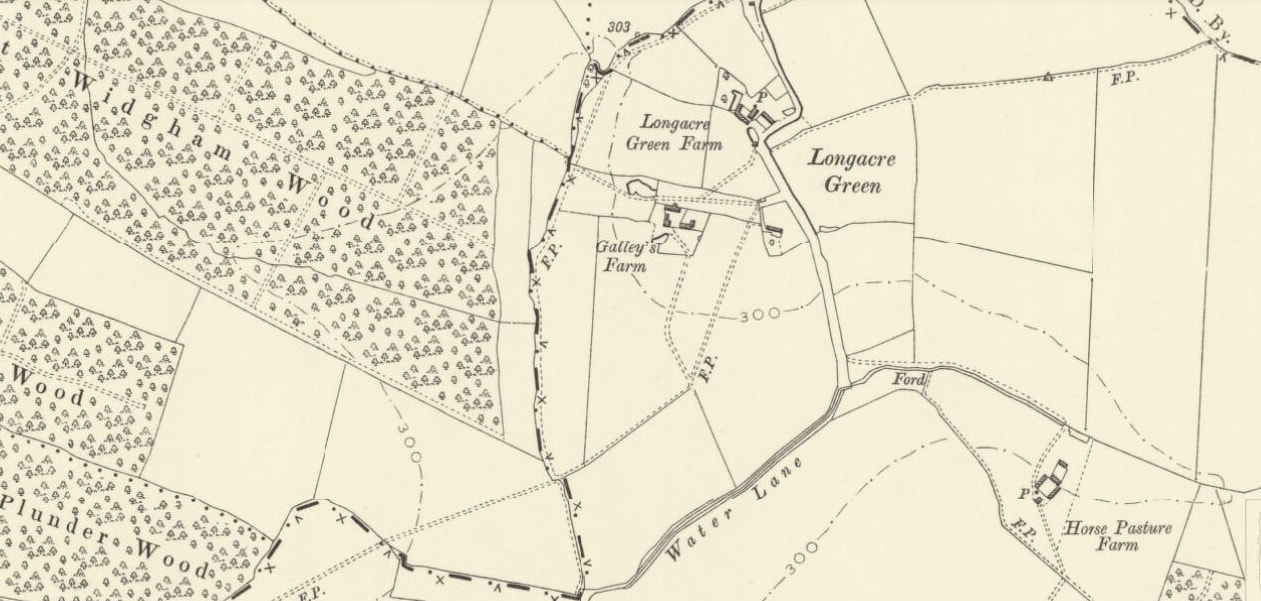
1903 Map of Great Bradley showing Long Acre Green
EAST GREEN
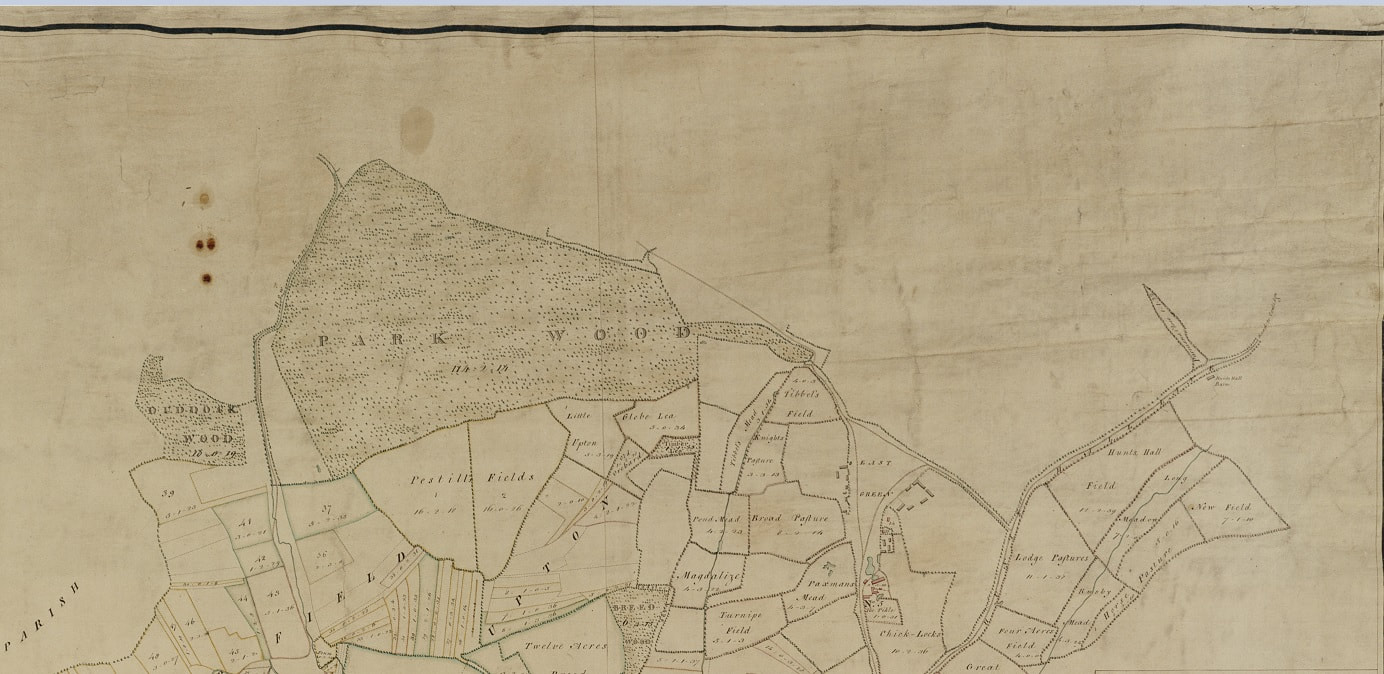
The one medieval settlement that survives as a recognisable part of the village is East Green. The 1719 map (below ) shows the triangular appearance of the green at the bottom. The map on the right from 1769 is rotated 90 degrees clockwise compared to the one on the left and the green is towards the top. St Johns College in Cambridge was formed in 1511 from the estate of Lady Margaret Beaufort, grandmother of Henry VIII. She owned the land round East Green and it was bequeathed to St John’s College on her death. Until very recently what we know as ‘East Green Farm’ was known as ‘College Farm’.
The one medieval settlement that survives as a recognisable part of the village is East Green. The 1719 map (below ) shows the triangular appearance of the green at the bottom. The map on the right from 1769 is rotated 90 degrees clockwise compared to the one on the left and the green is towards the top. St Johns College in Cambridge was formed in 1511 from the estate of Lady Margaret Beaufort, grandmother of Henry VIII. She owned the land round East Green and it was bequeathed to St John’s College on her death. Until very recently what we know as ‘East Green Farm’ was known as ‘College Farm’.
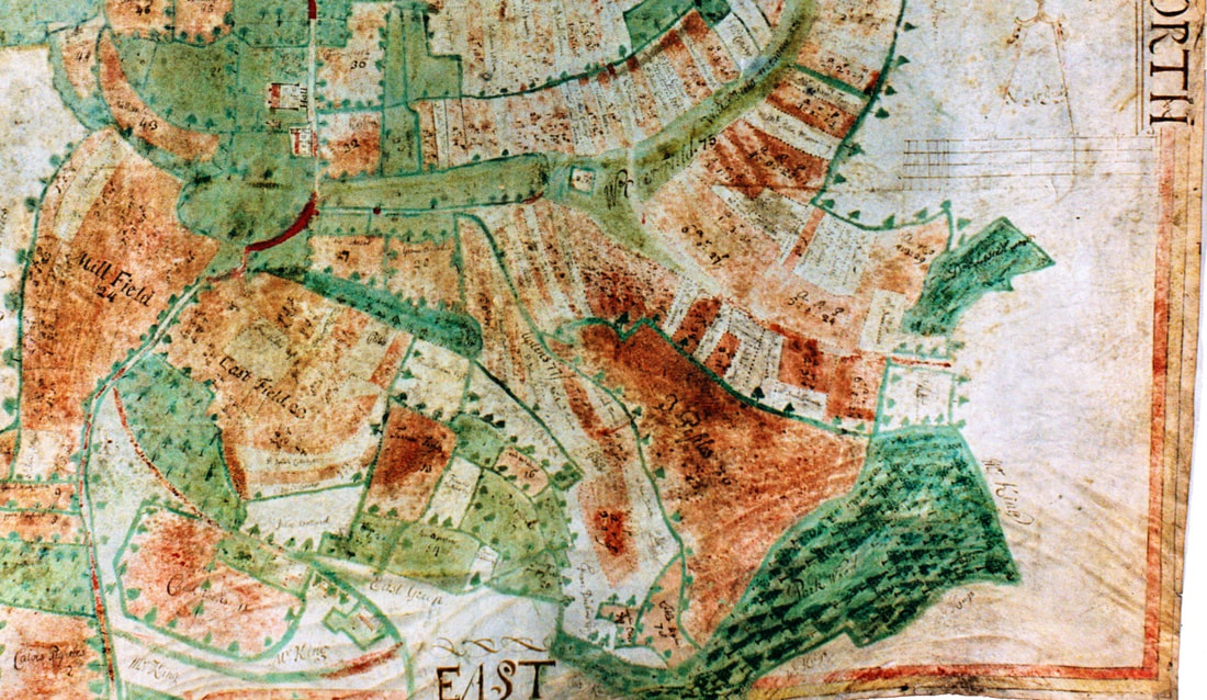
1719 Map of Great Bradley wiht East Green at the Bottom
1767 Map of Great Bradley, with East Green towards the top
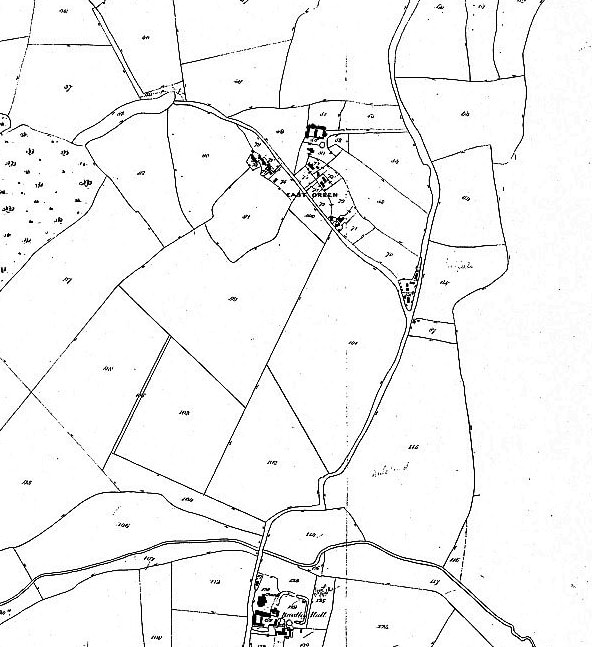
1842 Tithe Map with East Green at the top centre
More maps are on our website at https://greatbradley.weebly.com/16th-17th--18th-century.html or in the archive https://os5.mycloud.com/action/share/a10835f9-04ae-4d1f-80a6-bdf27c90ee70
