Archaelogical Records for Great Bradley
This is the complete record of 54 archaeological/ historic finds listed in the Suffolk Historic Environment Record from 2016. It covers everything from Neolithic arrow heads to an abandoned medieval village to the site of a brick kiln. Some of the latest finds were from when the River Stour pipeline was sunk in 2011 and the Roman bell in the picture above was found on the village allotments in 2018.
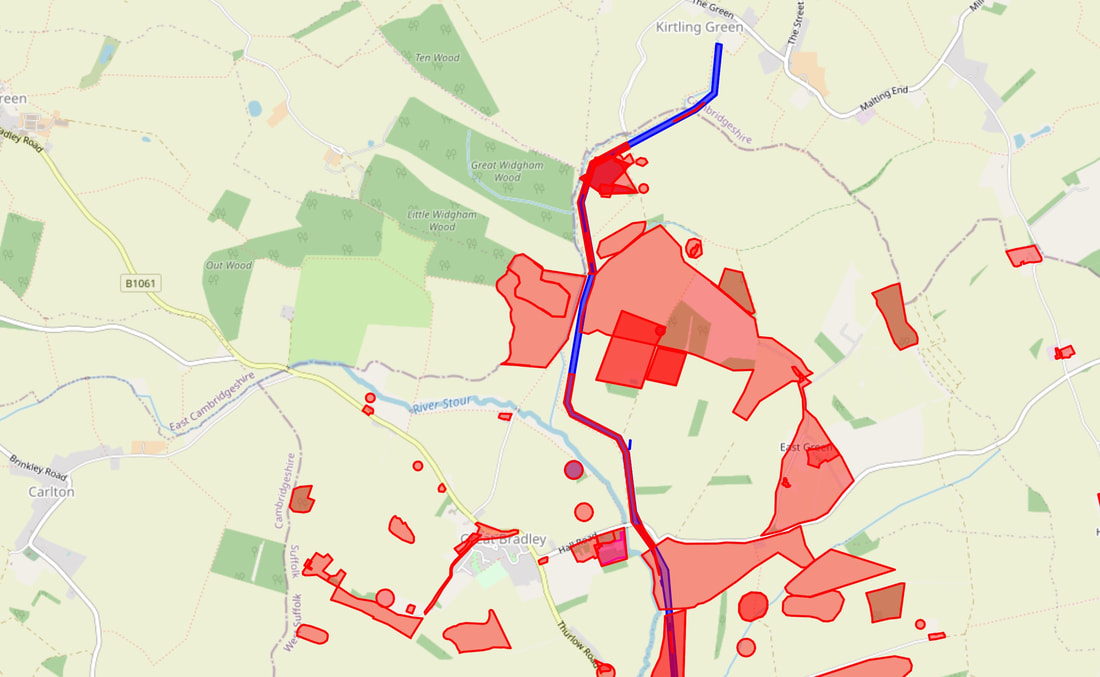
For an interactive map of the finds below go to this link https://heritage.suffolk.gov.uk/map?center=46789.537025499216,6827611.110149341
In the list below, click on the reference number to see further details and a location map
For an interactive map of the finds below go to this link https://heritage.suffolk.gov.uk/map?center=46789.537025499216,6827611.110149341
In the list below, click on the reference number to see further details and a location map
Archaeological finds in Great Bradley
| SHER Number | Name | Location |
|---|---|---|
| BYG 001 | The Hall | GREAT BRADLEY |
| BYG 002 | Ring ditch and artefact scatter of flakes, scraper and a core, of unknown date. | GREAT BRADLEY |
| BYG 003 | Roman artefact scatter of pottery and tile. (Rom) | GREAT BRADLEY |
| BYG 003 | Overlapping linear features, includig a possible rectangular enclosure, visible as cropmarks. (Un) | GREAT BRADLEY |
| BYG 004 | Roman artefact scatter of pottery sherds. (Rom) | GREAT BRADLEY |
| BYG 004 | Linear feature and ring ditch of unknown date, visible as cropmarks. (Un) | GREAT BRADLEY |
| BYG 004 | Iron-Age artefact scatter of pottery, including three hand-made sherds with burnt flint grit. (IA) | GREAT BRADLEY |
| BYG 005 | Longacre Green | GREAT BRADLEY |
| BYG 006 | Church of St Mary | GREAT BRADLEY |
| BYG 007 | Post Medieval post mill shown on a map of 1783. | GREAT BRADLEY |
| BYG 008 | Ever Green | GREAT BRADLEY |
| BYG 009 | Ever Green | GREAT BRADLEY |
| BYG 010 | Mesolithic artefact scatter, including a tranchet axe and a small group of flakes. | GREAT BRADLEY |
| BYG 011 | Possible Medieval moated site and trackway. | GREAT BRADLEY |
| BYG 012 | Thurlow Road | GREAT BRADLEY |
| BYG 013 | Hart Wood | GREAT BRADLEY |
| BYG 014 | Bradley Park Wood | GREAT BRADLEY |
| BYG 015 | College Grove | GREAT BRADLEY |
| BYG 016 | Bases Wood | GREAT BRADLEY |
| BYG 017 | Fox Farm | GREAT BRADLEY |
| BYG 018 | Lower Hill Farm | GREAT BRADLEY |
| BYG 019 | `Field 11' | GREAT BRADLEY |
| BYG 020 | `Field 29' | GREAT BRADLEY |
| BYG 021 | `Field 38'; Horse Pasture Farm | GREAT BRADLEY |
| BYG 022 | `Field 36'; Burnt House Field (TM) | GREAT BRADLEY |
| BYG 023 | `Fields 33 & 36'; Longacre Green; Galleys Farm (Med) | GREAT BRADLEY |
| BYG 023 | `Fields 33 & 36'; Longacre Green; Galleys Farm (PMed) | GREAT BRADLEY |
| BYG 023 | Field 36; Longacre Green; Galleys Farm (Preh) | GREAT BRADLEY |
| BYG 024 | `Field 34'; Longacre Green | GREAT BRADLEY |
| BYG 025 | `Field 34'; Longacre Green | GREAT BRADLEY |
| BYG 029 | Kirtling Green to Wixoe Pipeline, Fields 54, 55 and 56 | GREAT BRADLEY |
| BYG 030 | Kirtling Green to Wixoe Pipeline, Fields 48-49, Roman features (Rom) | GREAT BRADLEY |
| BYG 030 | Kirtling Green to Wixoe Pipeline, Fields 48-49, prehistoric features (Preh) | GREAT BRADLEY |
| BYG 030 | Kirtling Green to Wixoe Pipeline, Fields 48-49, medieval and undated features | GREAT BRADLEY |
| BYG 031 | Fennells(?) Wood | GREAT BRADLEY |
| BYG 032 | "Davids" Wood. | GREAT BRADLEY |
| BYG 033 | Buckles Ley and Grove (tithe map plot 86) | GREAT BRADLEY |
| BYG 034 | Handy Bar Grove (tithe plot 216) | GREAT BRADLEY |
| BYG 035 | Slitfield(?) Wood (tithe plot 219) | GREAT BRADLEY |
| BYG 036 | Grove Wood? (tithe map plot 203) | GREAT BRADLEY |
| BYG 037 | Cottage Blacksmiths (tithe plot 132). | GREAT BRADLEY |
| BYG 038 | Kirtling Green to Wixoe Pipeline Route, Fieldwalking | GREAT BRADLEY |
| BYG 039 | Kirtling Green to Wixoe Pipeline Route, Fieldwalking | GREAT BRADLEY |
| BYG 040 | Kirtling Green to Wixoe Pipeline Route, Fieldwalking, Roman | GREAT BRADLEY |
| BYG 041 | Kirtling Green to Wixoe Pipeline, Field 56, medieval features (Med) | GREAT BRADLEY |
| BYG 041 | Kirtling Green to Wixoe Pipeline, Field 55, prehistoric features | GREAT BRADLEY |
| BYG 042 | Kirtling Green to Wixoe Pipeline, Field 54, post-medieval features | GREAT BRADLEY |
| BYG 043 | Kirtling Green to Wixoe Pipeline, Field 54, prehistoric features | GREAT BRADLEY |
| BYG 044 | Kirtling Green to Wixoe Pipeline, Field 54, prehistoric features | GREAT BRADLEY |
| BYG 045 | Great Bradley DMV | GREAT BRADLEY |
| BYG MISC | Former deer park at Great Bradley (Med) | GREAT BRADLEY |
| BYG Misc | Mill field (tithe plot 65) (Med) | GREAT BRADLEY |
| BYG Misc | Findspot of a Neolithic arrowhead. (Neo) | GREAT BRADLEY |
| BYG Misc | Galleys Farm (Un) | GREAT BRADLEY |
