Bronze/ Iron Age Great Bradley
This information builds on the History of Great Bradley published in the year 2000 by a dedicated team of villagers led by Barbara Buchs and is downloadable from the website at https://greatbradley.weebly.com/published-histories.html
|
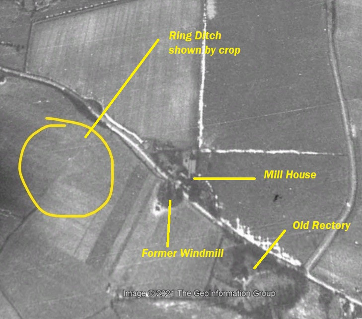
In 1984 a Bronze Age ring ditch, about 20m diameter, was identified from soil marks in the field to the left as you go down Bradley Hill. See enclosed photo from 1946. The darker ring can be seen with a much lighter mark at its centre.
There was also some Neolithic/Early Bronze Age material found, consisting of 9 flakes, a scraper adjacent to the cropmark. Also three 4th century Nene Valley colour-coated pottery sherds. No trace of the ring ditch can be seen on the ground |
In 2011 a pipeline was laid underground alongside Kirtling Brook and the River Stour. This pipeline enables more water from the reservoir at Kirtling to be moved to Essex without having to put vastly increased volumes of water in these watercourses, which could disrupt the ecosystem of both the brook and the River Stour. The archaeological surveys undertaken when the pipeline was laid have been the most comprehensive in the area.
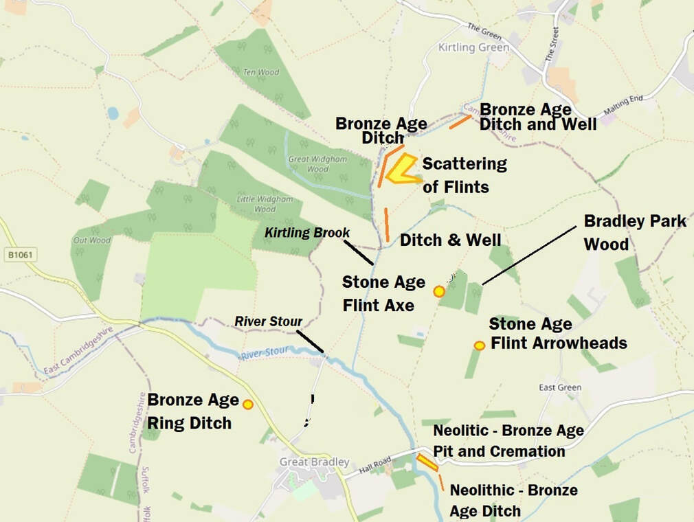
During work on the pipeline, at least four locations where there were ditches and Bronze Age pottery (2,350BC – 701BC). Three of these ditches run alongside the course of the current Kirtling Brook and its characteristic weirs, so perhaps they were linked to a stream for water or helped to form a defensive barrier.
During work on the pipeline, at least four locations where there were ditches and Bronze Age pottery (2,350BC – 701BC). Three of these ditches run alongside the course of the current Kirtling Brook and its characteristic weirs, so perhaps they were linked to a stream for water or helped to form a defensive barrier.
|
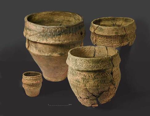
At a site across the river from the current graveyard, evidence was found of of a watercourse, a ditch and a cremation site from the late Neolithic/late Bronze Age (3,000 – 701BC). The cremation site contained pottery, flint arrow heads and tools such as scrapers and axe heads, along with human remains. The cremation site contained pottery, flint arrow heads and tools such as scrapers and axe heads, along with human remains. The remains totalled about half a full person an appeared to have originally been wrapped in a fabric bag or cover. This implies that a great effort must have been put into collecting the bones after they had cooled on the funeral pyre.
It is an interesting thought that people have been coming to live, work and die here for about 5,000 years and that, although the people buried in the current graveyard might be separated by thousands of years in time from those that were cremated here, their final resting places are just 100 metres apart. |
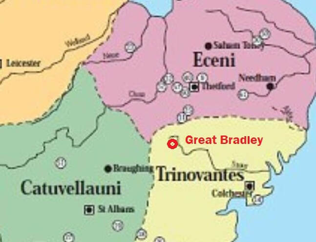
The first Iron Age settlers came from southern Holland/ eastern Belgium in about 500BC. ‘Celts’ is another term used for Iron Age peoples. A bit like today, where Great Bradley sits close to the border of Suffolk, Cambridgeshire and Essex, it was probably close to the border of three main Iron Age peoples. To the north were the Iceni, originally from France; to the west were the Catuvellauni from Belgium and the last major group to settle here were the Trinovantes. The map shows Great Bradley as being in the territory of the Trinovantes, but we can’t be sure where the borders were exactly
Some of the woodland in the area would have been cleared by this time as farming began to be practiced. A few items that have been found around Great Bradley that can be specifically dated to the Iron-Age.
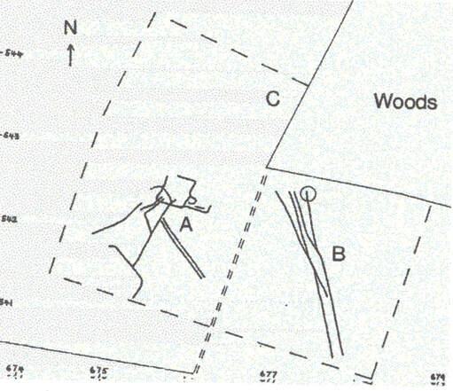
Just south of Bradley Park Wood (pictured at the top of the page) there are crop marks showing trackways. They were found by the Haverhill & District Archaeology Group who conducted a field walk of the area in 1985. The tracks are grouped in two sets, marked A & B on this diagram. Iron age pottery has been also found, including some with burnt flint grit and one sherd from a `Belgic' jar, which was one of the earliest types of pottery to be found in the UK created with a potter’s wheel. The map to the left shows the location of the finds
Just south of Bradley Park Wood (pictured at the top of the page) there are crop marks showing trackways. They were found by the Haverhill & District Archaeology Group who conducted a field walk of the area in 1985. The tracks are grouped in two sets, marked A & B on this diagram. Iron age pottery has been also found, including some with burnt flint grit and one sherd from a `Belgic' jar, which was one of the earliest types of pottery to be found in the UK created with a potter’s wheel. The map to the left shows the location of the finds
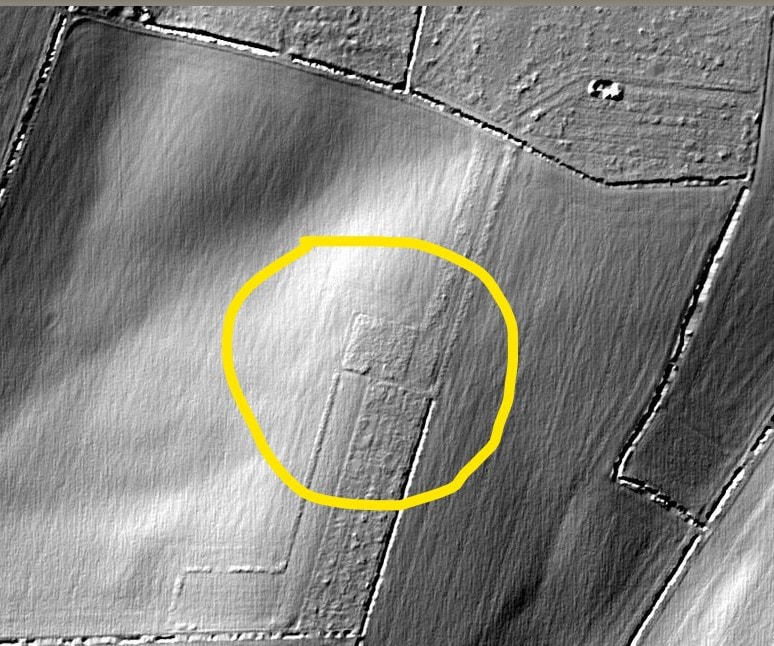
There is also a possible hut site below Bradley Park Wood, which shows up as the square shape in the centre of this black & white LIDAR (Light Detecting And Ranging) image taken with a laser. Because the area round Great Bradley has been extensively farmed, the effect of the plough has often removed features, thus making identification difficult.
To find out more about the archaeology of the area see https://greatbradley.weebly.com/archaeological-finds.html. You can find more pictures and information about the water transfer scheme at https://greatbradley.weebly.com/water-transfer-scheme.html.
